כיכר המדינה יוצאת לדרך: המגדלים, הפארק והדירותKikar HaMedina Gets Under Way: The Towers, the Park and the Apartments
הכיכר הגדולה בתל אביב תוכננה בשנות החמישים ונשארה חניון פתוח במשך עשורים. היום הבנייה בעיצומה, ובמרכזה מתוכנן פארק בן כ־50 דונם.Tel Aviv's largest square was designed in the 1950s and remained an open car park for decades. Today construction is in full swing, and at its center a park of about 50 dunam is planned.
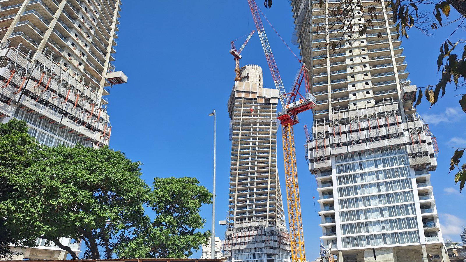
צילום: Rakoon · ויקישיתוף · CC0Photo: Rakoon · ויקישיתוף · CC0
כיכר המדינה היא הסמל המוכר ביותר של רובע 4, וגם החידה הארוכה ביותר שלו. היא תוכננה במקור בשנות החמישים כמוקד עירוני, אבל במשך עשרות שנים מרכזה נותר שטח פתוח ששימש בעיקר לחניה.
רק בדצמבר 2022 התקבל היתר הבנייה, כשבעים שנה אחרי התכנון המקורי. היום הבנייה בעיצומה, ואת המגדלים אפשר לראות כבר מכל האזור.
מה נבנה שם
הפרויקט כולל שלושה מגדלי מגורים, שניים מהם בני 40 קומות והשלישי בן 37, ובסך הכל 453 דירות. מתחתיהם נבנה חניון תת קרקעי בשלוש קומות עם כ־1,620 מקומות חניה.
את הבנייה מבצעות אלקטרה בנייה ואשטרום. התכנון האדריכלי של משרד יסקי מור סיון, שעיצב את המגדלים כמתפתלים סביב עצמם, כפרשנות עכשווית לצורתה המעגלית של הכיכר.
הפארק, ולא המגדלים
מבחינת מי שגר באזור, החלק המעניין בפרויקט הוא דווקא מה שקורה בין המגדלים.
מה מתוכנן בשטח הציבורי
למה זה לקח כל כך הרבה זמן
הבעלות על הקרקע במתחם מפוצלת בין מספר רב של בעלי מגרשים שהתאגדו לקבוצות רכישה. מבנה בעלות כזה מחייב הסכמות רחבות בכל שלב, וזה אחד ההסברים המרכזיים לפער בין התכנון המקורי לביצוע בפועל.
גם אחרי קבלת ההיתר מדובר בפרויקט הנדסי מורכב: ביסוס על שלוש רפסודות המרוסנות בכלונסאות, ומבנה שלד עם גרעין עגול הנבנה בתבנית מחליקה.
מה מתוכנן בשדרה ההיקפית
לצד הפארק מתוכננת שדרה עירונית שתקיף את הכיכר כולה. לפי פרסומי הפרויקט, רוחבה יהיה כ־19 מטר, והיא תכלול מסלולי אופניים וריצה דו סטריים, רצועת גינון תחומה באבני גרניט, אזור הליכה מרוצף, ספסלים וקיוסקים.
בשדרה מתוכננות שלוש שורות עצים, ובהן עצי פיקוס קיימים שנשמרו. חלק מהעצים שהיו במרכז הכיכר הועתקו למשתלה לתקופת הבנייה, והם אמורים לחזור לשטח עם השלמת הפיתוח.
המחלוקת על מבנה הציבור
לא הכל בפרויקט התקבל בהסכמה. לצד המגדלים מתוכנן מבנה ציבור שיכלול בית ספר יסודי ומרכז קהילתי, ותושבים באזור התארגנו בעבר נגד התוכנית בטענה שהיא באה על חשבון שטח הפארק.
מנגד, העירייה נימקה את הצורך בגידול מספר הילדים בעיר ובמחסור צפוי בכיתות במרכז ובצפון תל אביב.
Kikar HaMedina is the best known symbol of District 4, and also its longest running riddle. It was originally designed in the 1950s as an urban focal point, but for decades its center remained an open space used mainly for parking.
Only in December 2022 was the building permit issued, some seventy years after the original design. Today construction is in full swing, and the towers can already be seen from all around the area.
What is being built there
The project includes three residential towers, two of them 40 stories and the third 37, with 453 apartments in total. Beneath them a three-level underground car park is being built with about 1,620 parking spaces.
Construction is carried out by Electra Construction and Ashtrom. The architectural design is by the Yaski Mor Sivan office, which shaped the towers as twisting around themselves, as a contemporary interpretation of the square's circular form.
The park, not the towers
For those who live in the area, the interesting part of the project is actually what happens between the towers.
What is planned in the public space
Why it took so long
Ownership of the land in the complex is split among a large number of plot owners who formed purchasing groups. An ownership structure like this requires broad agreement at every stage, and this is one of the main explanations for the gap between the original design and actual construction.
Even after the permit was issued, this is a complex engineering project: foundations on three raft slabs anchored by piles, and a frame structure with a round core built using slip forming.
What is planned along the perimeter boulevard
Alongside the park, an urban boulevard is planned that will encircle the entire square. According to the project's publications, it will be about 19 meters wide, and will include two-way cycling and running lanes, a planting strip edged with granite stones, a paved walking area, benches and kiosks.
Three rows of trees are planned along the boulevard, including existing ficus trees that were preserved. Some of the trees that stood at the center of the square were moved to a nursery for the construction period, and are meant to return to the site once the development is complete.
The dispute over the public building
Not everything in the project was met with agreement. Beside the towers a public building is planned that will include an elementary school and a community center, and residents in the area previously organized against the plan, arguing that it comes at the expense of the park.
The municipality, for its part, justified the need by the growing number of children in the city and an expected shortage of classrooms in central and northern Tel Aviv.
הנתונים נכונים למועד הפרסום. Information is current as of publication.